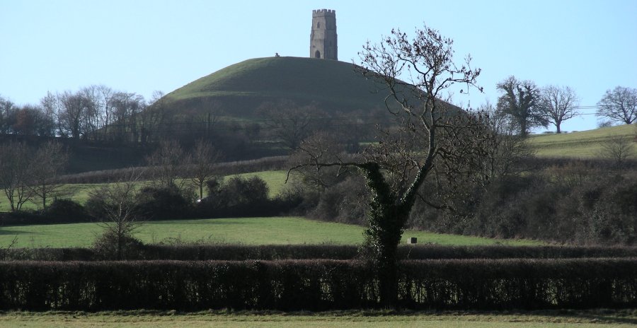
Glastonbury Tor.


Crossing a farm on the way to Wells....


Glastonbury,

Somerset

11th - 13th February 2011


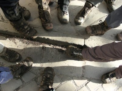
Muddy boots!

Two independent walks has emerged as possibilities by the time breakfast had concluded, one constituting the main group, heading across the flat landscape towards Wells, which we could see from the elevated Paddingtom Farm, whilst the other path, being Tim Porter's chosen route, heading towards Glastonbury Tor and beyond. I was in two minds however I opted to accompany the larger group, as I felt Zoltan would benefit more from the cultural aspects of visiting Wells. I had been there the previous year, after the hiking club's trip to Cheddar Gorge. The sky was clear of clouds and the landscape was bathed in warm sunshine and all were in good spirits. Walking down from the farm to the roundabout on the edge of town with Glastonbury Tor now in full view, for a while we seemed to be proceeding along the A39 Wells Road north. I made the cardinal mistake of enquiring whether the intention was to head off across the countryside at some stage, whereas I ought to have been asking when we would be doing so, or perhaps the best policy might have been not to have asked at all. Soon we reached a road that led off from the Wells Road, known as Long Drove. Instead we followed a public path along a canal, as indicated on the map. Soon we reached the outskirts of a farm and this is where further problems arose. The land was covered by a cross section of canals and the only access path beyond took us through a narrow strip that had been converted from grassland to a grey mass of thick sticky mud, knee deep, reminding me somewhat of my experiences on the Gaucho Trail in Patagonia in March 2010. What's more, the way seemed blocked by a herd of cattle voicing their disapproval, fronted by the biggest bull you have ever laid your eyes upon! Whilst Martin and one or two others managed to make it across, the rest of us turned back, crossing fields on the farm in an attempt to find an alternative route. However, all attempts proved fruitless, as we found ourselves hemmed in by the system of canals.


View towards Glastonbury Tor as we head off in the direction of Wells.


First following the canal public footpath towards Hartlake Farm (left), we were forced back along Long Drove Road, just off the A39.


The public footpath across the flat towards Hartlake Farm led us into a mud bath, as we found ourselves hemmed in by the canal system.


Lunch at Wellesley Farm.


The problem was compounded somewhat by the fact that the farmer whose land we had been crossing, albeit on a public footpath, came out and yelled and swore at Martin, as he was adamant that we had allegedly upset his cows, one of them ending up in the canal. His wife also had a go when Martin reached the farm and further argument ensued. His wife grudgingly conceded that the route was indeed a public footpath, though he claimed that the path was marked incorrectly on the OS map. I think not. We had no alternative but to turn back the way we had come, taking Long Drove Road, long and straight as far as the eye could see. We had hoped to meet up with the others later. We reached the end of Long Drove Road. At that stage Martin had reached the village of North Wooten. I was keen to find a route up the side of a ridge that lay before us, the length of which Martin had intended to walk from the direction of North Wooten. I had felt that the walk up to then had been on the flat and largely uneventful. Only Chris seemed interested and agreed to follow, probably more out of a sense of camaraderie than a real desire. We turned left towards the village of Launcherley. At the top of the road we split from the rest of the group and after turning into Launcherley Road, we continued for a while before struggling up the hillside, crossing what looked like a motor-cross circuit, eventually reaching some semblance of a summit. The problem was that what might have seemed like an obvious route down turned out to be fenced off, so we followed the fence that separated the woodland, Twinhills Woods and Meadow, to be exact, from open field, until we encountered a somewhat muddy path (marked) that led down the steep hillside, until we met up with the others, including Martin, at Wellesley Farm. We stopped for a lunch break at the farm before continuing into Wells.


View from the highway towards Wels cathedral on the outskirts of the town.


A drained moat surrounding the Bishop's Palace in Wells, an idyllic setting.


The architectural splendour of Wells Cathedral.


Wells market on a Saturday.


Glastonbury is a small town in Somerset, situated at a dry point on the low lying Somerset Levels, 23 miles south of Bristol. The town lies in the Mendip district and is less than 1 mile across the River Brue from the village of Street. Evidence gleaned from timber track-ways such as the Sweet Track, an ancient causeway, show that Glastonbury has been inhabited since Neolithic times. The Sweet Track was built in 3807 or 3806 BC and has been claimed to be the oldest road in the world. Construction was of crossed wooden poles which were driven into the waterlogged soil to support a walkway that consisted mainly of planks of oak, laid end-to-end. The track was only used for a period of around 10 years and then abandoned, probably due to rising water levels. Glastonbury Lake Village was an Iron Age village, approximately 2 miles west of Glastonbury, dating back to the Bronze Age. Centwine was the first Saxon patron of Glastonbury Abbey, which dominated the town for the next 700 years. One of the most important abbeys in England, it was the site of Edmund Ironside’s coronation as King of England in 1016. Many of the oldest surviving buildings in the town, including the Tribunal (built in the 15th century as a medieval merchant's house), George Hotel and Pilgrim’s Inn (built in the late 15th century to accommodate visitors to Glastonbury Abbey  and the Somerset Rural Life Museum (a museum of the social and agricultural history of Somerset, housed in buildings surrounding a 14th century barn once belonging to Glastonbury Abbey. The Church of St John the Baptist dates from the 15th century.


"Reclaim Love" Day celebrations at Glastonbury Tor.


After crossing the highway via a bridge, we passed via Manor Farm into the town centre, arriving at the Bishop's Palace. The palace is surrounded by gardens, outer battlements and a moat, however the moat was virtually empty on this occasion (Gordon informed us that it was full when he visited it again the next day). White mute swans are common in England and swans on the moat have, for centuries, been trained to pull a string attached to a bell when they want feeding (from a window in the entrance gatehouse). In the UK all swans are owned by the monarch. The market place in the town centre, accessible via the Bishop's Rye, was in full swing. The market is open on Wednesdays and Saturdays. The decision that had been taken at the beginning of the walk to take the bus back to Glastonbury seemed justified, considering the amount of time we lost at the canals. The group had split and a few continued on to Wookie Hole. A cloudburst suddenly hit the town and the skies opened up as Maeve led us to the bus station. Arriving in Glastonbury, there was still sufficient light left for us to venture up to Glastonbury Tor. The views from there of the surrounding countryside are magnificent. We found ourselves in the midst of a celebration.

A large group of happy people had gathered at the tor, fronted by a guitarist with a rather good voice, accompanied by a flautist. Renditions of "Give Peace a Chance" seemed appropriate. The event had been organised as part of the "Reclaim Love" celebration being conducted around the globe, their "May all the beings in all the worlds be happy and at peace" theme aptly demonstrated as they formed a ring around the tor and chanted the words. This being a family celebration, small children with their faces painted were making the most of it. To their delight, a woman passed around cake and thanked everyone for coming and we could not help but be drawn in by the infectious nature of the happy group, despite us looking distinctly bedraggled and out of place in our muddy boots.


Families out celebrating "Reclaim Love" Day on 12th February. Forming a ring around Glastonbury Tor, they chanted "May all the beings in all the worlds be happy and at peace".


Glastonbury Abbey was a rich and powerful monastery and may have been a site of religious importance in pre-Christian times. Since at least the 12th century the Glastonbury area was frequently associated with the legend of King Arthur, a connection promoted by medieval monks who asserted that Glastonbury was Avalon. The abbey was suppressed during the Dissolution of the Monasteries between 1536 and 1541 under King Henry VIII. The dissolution still represents the largest legally enforced transfer of property in English history since the Norman Conquest.

The abbey itself was founded by Britons, and it dates at least to the early 7th century. Glastonbury fell into Saxon hands after the Battle of Peonnum in 658. The Saxons under Cenwalh of Wessex conquered Somerset as far west as the River Parrett, perhaps with the intention of gaining control of the valuable abbey. However, Cenwalh allowed the British abbot, Bregored, to stay in power, a move perhaps intended as a show of good faith to the defeated Britons. After Bregored's death in 669, he was replaced by the Anglo-Saxon Behrtwald, but British monks remained for many years after. King Ine of Wessex enriched the endowment of the community of monks already established at Glastonbury. He is said to have directed that a stone church be built in 712, the foundations of which now form the west end of the nave. Glastonbury was ravaged by the Danes in the ninth century. The abbey church was enlarged in the tenth century by the Abbot of Glastonbury, Saint Dunstan, the central figure in the tenth-century revival of English monastic life, who instituted the Benedictine Rule at Glastonbury, where monks lived communally under the authority of an abbot. Dunstan became Archbishop of Canterbury in 960. Dunstan built new cloisters as well. In 967, King Edmund was laid to rest at Glastonbury. 


Glastonbury Abbey Ruins - photo courtesy of Wikipedia.


In 1016 Edmund Ironside, who had lost England to King Cnut the Great (also known as Canute) of Denmark but held onto the title of King of Wessex, was buried there too. At the Norman Conquest in 1066, the wealth of Glastonbury made it a prime prize and a new Norman abbot, Turstin, was appointed.  In 1077, Turstin was dismissed after his armed retainers killed monks right by the High Altar. In 1086, when Domesday Book was commissioned, Glastonbury Abbey was the richest monastery in the country. In 1184, a great fire at Glastonbury destroyed the monastic buildings. Reconstruction began almost immediately and the Lady Chapel, which includes the well, was consecrated in 1186. There is evidence that, in the twelfth century, the ruined nave was renovated enough for services while the great new church was being constructed. If pilgrim visits had fallen, the discovery of King Arthur and Queen Guinevere’s grave in the cemetery in 1191 provided fresh impetus for visiting Glastonbury. According to two accounts by the chronicler, Giraldus Cambrensis, the abbot, Henry de Sully, commissioned a search, discovering at the depth of 5 metres, a massive hollowed oak trunk containing two skeletons. Above it, under the covering stone, according to Giraldus, was a leaden cross with the unmistakably specific inscription Hic jacet sepultus inclitus rex Arthurus in insula Avalonia ("Here lies interred the famous King Arthur on the Isle of Avalon").

Five years later, in 1197, Glastonbury Abbey was annexed to the diocese of Bath and Wells. The bishops continued to use the title Bishop of Bath and Glastonbury until finally renouncing their claim to Glastonbury in 1219. Services in the reconsecrated Great Church had begun on Christmas Day, 1213, most likely before it was entirely completed. King Edward I and Quenn Elenor attended the magnificent service at the reburial of King Arthur's remains to the foot of the High Altar in 1278. In the 14th century, only Westminster Abbey was more richly endowed and appointed than Glastonbury. The abbot of Glastonbury kept great state, now attested to simply by the ruins of the abbot's kitchen, with four huge fireplaces at its corners. The kitchen was part of the magnificent Abbot's house begun under Abbot John de Breynton (1334–42). It is one of the best preserved medieval kitchens in Europe, and the only substantial monastic building at surviving at Glastonbury. The conditions of life in England during the Wars of the Roses became so unsettled that a wall was built around the Abbey's precincts.

At the start of the Dissolution of the Monasteries in 1536, there were over 800 monasteries, nunneries and friaries in England. By 1541, there were none.  In September 1539, the Abbey was stripped of its valuables and Abbot Richard Whiting (Whyting), who had been a signatory to the Act of Supremacy that made Henry VIII the head of the church, resisted and was hanged, drawn and quartered as a traitor on Glastonbury Tor on November 15, 1539. The ruins of Glastonbury Abbey were purchased by the Bath and Wells Diocesan Trust in 1908. The ruins are therefore now the property of the Church of England.


Guitarist and flautist lead the crowd on in celebration of "Reclaim Love" Day at Glastonbury Tor.


Views of the Somerset countryside from Glastonbury Tor.


The descent from Glastonbury Tor on our way back to Paddington Farm.


We made our way back down the hillside to Paddingtom Farm, meeting the group who had first been to Wookie Hole en route. In the evening we returned to the Who'd a thought it pub in Northload Street (Zoltan decided to stay behind), albeit that we had reserved and had to be out early. With couples celebrating Valentine's Day, the restaurant was in popular demand. Back at the farm, the trusty duo comprising Dave and Rob entertained us with a rare acoustic set, which we thoroughly enjoyed. Dave's canny response in dodging song requests amounted either to "you must have missed that when we played that earlier" to "we don't do prog". So Supertramps's "Give a little Love" is prog, Dave? The remaining few turned in after midnight.


The group at the start of he walk at Paddington Farm.


Rob and Dave entertain the hiking group audience with an acoustic set.


[UK - index] [Home Page]

Malborough & Avebury [1] [2],  Glastonbury,  Lacock [1] [2]


Links to other websites:

Paddingtom Farm Trust - website

Avebury, a present from the past - website

Some detail on Avebury's destruction - BBC webpage

Silbury Hilll's Anglo-Saxon makeover - BBC webpage

Glastonbury Abbey - website

Glastonbury Tor - wiki webpage

Glastonbury Festival - website

Wells Moat Walk - webpage

  • Reclaim Love 12th February 2011 - website

  • Lacock village - National Trust webpage

    Note: Some photos on this page taken by Zoltan Kiss.