|
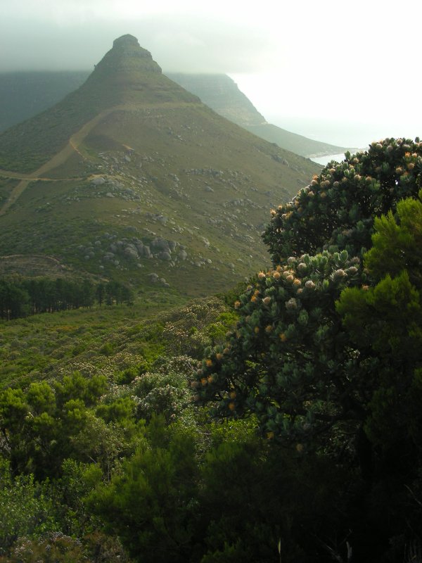
Looking back across a landscape of
fynbos, where Myburgh Ravine joins the head of the valley. |
|
|
Ain't nothing but a hound dog! |
|
|
|
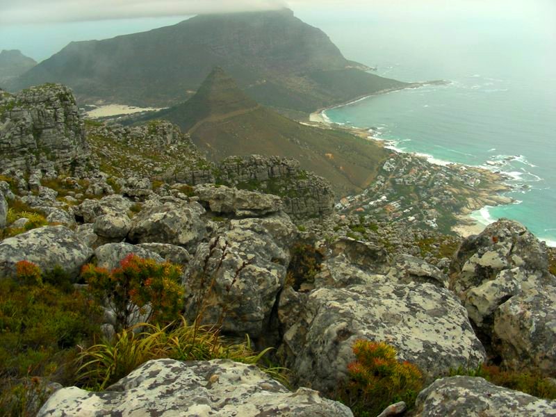
Pausing for a moment to turn
back to Myburgh Ravine as it funnels down to intersect Longkloof
Valley, one is able to see far south across towards Vlakkenberg and
False Bay beyond, with Constantia Nek over to the left. Vlakkenberg
is the mountain stretching from Constantia Nek to Constantiaberg,
separating Constantia from Hout Bay. As soon as one is out in the
open, having climbed out of Myburgh Ravine, one is greeted by a
landscape covered in fynbos, significantly taller than I recall it
having been. A huge rock to the left assumes the shape of the head
of some beast, a canine perhaps. The path meanders up the valley
head and is soft and marshy underfoot. I remembered the trail
reaching a large cairn en route to Twelve Apostles on the Atlantic
side. Though I may have passed by it, I was distracted by the cloud,
known as a Black South Easter, rolled in, until I realised that I
had totally lost my bearings and sense of direction, despite
maintaining my course on the clearly defined path. I continued until
I could see what looked like the blue waters of the ocean before
being able to reach a lookout of any sort, in the hope of
establishing my precise location.
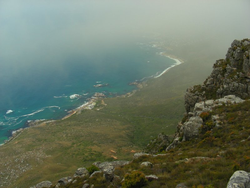
My heightened concern
turned to distinct relief when I reached the edge and found myself
on Twelve Apostles gazing down at Oudekraal, with Judas Peak, the
12th peak of the Twelve Apostles mountain range, to my left.
Clifton, Camps Bay and Lions Head to the north were however obscured
by the haze and cloud. I could see the coastal road from Camps Bay
as it ran past Bakoven and the Oudekraal Hotel. It dawned on me that
the path I had been on had led me in a westerly direction towards
the Atlantic, on a course parallel to Longkloof Valley below, which
I had walked up earlier, towards Constantia Nek. |
|
 |
|
First sighting of Little Lions Head
above Llandudno, with Sandy Bay nudist beach beyond. |
|
|
|
The descent of Llandudno Path
below Judas Peak. Llandudno Beach comes into view. |
|
|
|
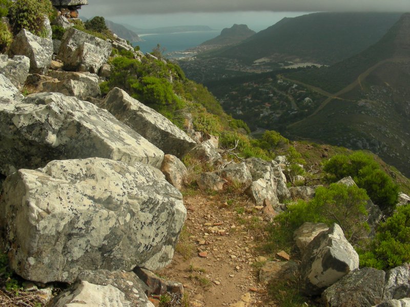
I was not out of the woods
yet, so to speak. I still had to find the route that led me off the
mountain via Llandudno Path. Going back down Myburgh waterfall was
not an option! I followed another path almost south, away from
Oudekraal, so as to avoid the track which we see me retrace my steps
to the ravine. The former drops down into a sloped valley, which I was
almost certain was the one I needed to be in, before doubling back
on itself to the right. I recognised the terrain, remembering that
the more apparent route down the middle of the valley was to be
avoided. I searched out for a path leading off to the right, as if
heading towards Judas Peak, but which would in all probability link
with Llandudno Path, still out of view at this stage. Content in the
knowledge that I had, through sheer luck and instinct, managed to
navigate my way here in somewhat alien weather conditions, I stopped
for my first tea break of the day and with a mobile signal present,
called my brother. |
|
 |
|
 |
|
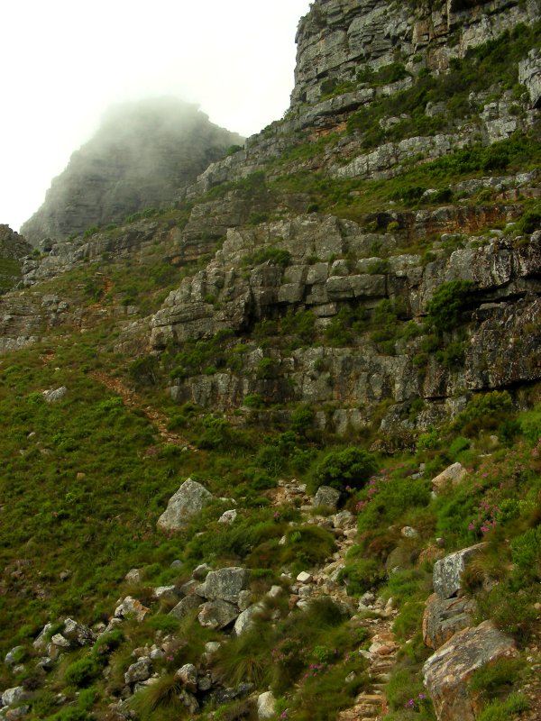
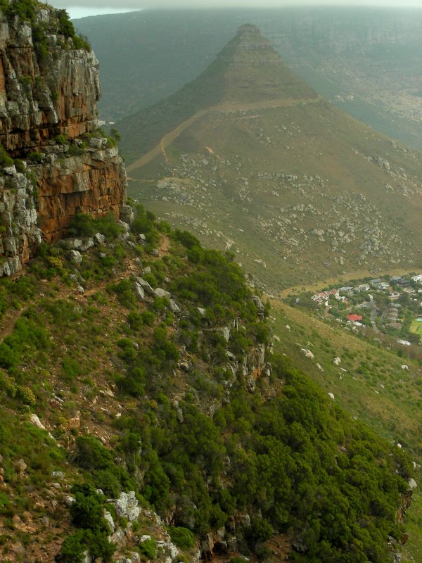
View up Llandudno Path towards Judas
Peak; Fynbos on Llandudno Path. |
|
|
|
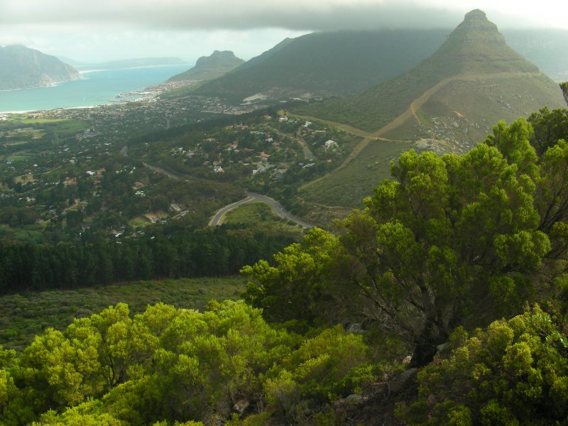
First glimpse of Hout Bay on
Llandudno Path. |
|
|
|
Though unlikely to admit it
to anyone later, I was acutely aware that I had pushed myself to the
edge of my comfort zone, which only served to remind of the danger
of taking Table Mountain for granted. A half an hour later, I
descended the steep ravine down a path that, initially at least,
proved a bit of a scramble, before becoming more stable, with the
appearance of it being maintained. As it rounds a corner below Judas
Peak (on my right), the cove that is Llandudno Beach, as well as
Little Lions Head, comes into view. Cars lined Victoria Road, which
joins Llandudno and Hout Bay. Soon I found myself below the cloud,
warmed by the rays of the penetrating sun.
Sporadically, I passed a
number of hikers heading up the ravine. The path reaches a traverse
that runs across a ledge below the ravine that may, in all
likelihood, only be descended with extreme difficulty from the
valley above. I could see A new addition to the Llandudno route in
the form of solid, metal hand-grips bolted to the rock, proved
suitably convenient when attempting the descent. After Hout Bay's
Sentinal, Hout Bay harbour, Chapmans Peak and Noordhoek Beach come
into view, the path drops down to Suikerbossie, where it joins the
Longkloof Valley route above Ruyteplaats Estate. Gazing west, as the
angle to the waters of the Atlantic below narrowed, the ocean
surface turned silver as it began to reflect the rays of the late
afternoon sunlight. To the south, an ominous layer of thick, low
Black South Easter cloud still hung over Karbonkelberg. Weather-wise
it had been a strange day, yet that only served to highlight its
uniqueness. |
|
 |
|
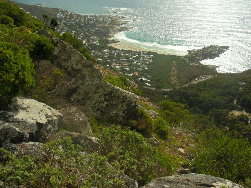
View across Hout Bay. To the right,
The Sentinal (above the harbour), Karbonkelberg (partially obscured by
clouds) and Little Lions Head. |
|
|
|
 * *
*
* *
* |
|